
N
N
O
O
R
R
T
T
H
H
W
W
E
E
S
S
T
T
S
S
A
A
N
N
C
C
T
T
U
U
A
A
R
R
Y
Y
S
S
T
T
E
E
W
W
A
A
R
R
D
D
S
S
H
H
I
I
P
P
P
P
L
L
A
A
N
N
N
N
A
A
S
S
H
H
U
U
A
A
,
,
N
N
H
H
Prepared by the
NASHUA REGIONAL PLANNING COMMISSION
for the
CITY OF NASHUA
COMMUNITY DEVELOPMENT DIVISION
JANUARY 2003

Northwest Sanctuary Stewardship Plan
City of Nashua
January 2003
Page i.
TABLE OF CONTENTS
I. INTRODUCTION
A. Background ............................................................................................................................................1
B. Stewardship Plan Goal and Objectives ..............................................................................................1
II. PROPERTY HISTORY
A. Site Overview.........................................................................................................................................2
B. Development Pressures........................................................................................................................2
III. ENVIRONMENTAL ASSESSMENT
A. Natural Resources .................................................................................................................................3
1. Pennichuck Watershed and Subwatersheds ..............................................................................4
2. Wetlands..........................................................................................................................................5
3. Wildlife ............................................................................................................................................6
IV. LAND USE PLAN
A. Existing Conditions...............................................................................................................................7
1. Land Uses........................................................................................................................................7
2. Adjacent Land Uses .......................................................................................................................7
3. Current Access................................................................................................................................8
Parking.........................................................................................................................................9
4. Existing Trail Network ................................................................................................................10
B. Passive Recreation and Watershed Protection ................................................................................10
1. Analysis of Impact Area..............................................................................................................10
Easements and Restrictions.....................................................................................................10
Wildlife Habitat ........................................................................................................................11
Watershed Protection...............................................................................................................12
Proposed Trails .........................................................................................................................14
Potential Trails and Connections............................................................................................15
Forest Management..................................................................................................................16
2. Uses and Limitations ...................................................................................................................17
3. Opportunities for Land Acquisition and Access .....................................................................19
V. STEWARDSHIP OPTIONS
A. Stewardship Organization .................................................................................................................20
1. Staff and Volunteer Resources ...................................................................................................20
B. Monitoring ...........................................................................................................................................21
C. Enforcement.........................................................................................................................................22
D. Resolution of Conflicts........................................................................................................................23

Northwest Sanctuary Stewardship Plan
City of Nashua
January 2003
Page ii.
E. Partnerships ........................................................................................................................................23
F. Trail Construction and Maintenance................................................................................................24
G. Publicity and Signs..............................................................................................................................25
H. Education..............................................................................................................................................26
I. Communication with Abutting Landowners and Towns .............................................................26
J. Funding.................................................................................................................................................27
APPENDICES
Appendix A: Summary of Research
Appendix B: Components of a Stewardship Plan
Appendix C: Acknowledgements
Appendix D: LCHIP Stewardship Plan Guidelines: Land Projects
Appendix E: Species likely/with potential to inhabit the site
Appendix F: Wildlife observed on the site
Appendix G: Easement Deed for Farley Road Logging Trail to Pennichuck Corporation
Appendix H: Research on Deerwood Drive Access
Appendix I: City of Nashua Water Supply Protection District Regulations
Appendix J: Audubon Society Sanctuary Rules and Regulations
Appendix K: New Hampshire State Statute Regarding Conservation Commissions
Appendix L: Conservation Land Sample Monitoring Form
Appendix M: City of Concord Conservation Open Space Ordinance
TABLES
Table 1: Area Locations and Descriptions on the Northwest Sanctuary............................................................4
Table 2: Wetland Functions & Values & Associated Species on the Northwest Sanctuary.............................6
Table 3: Easements and Restrictions on the Northwest Sanctuary...................................................................11
Table 4: Restricted Activities in Watershed Protection Areas ...........................................................................13
Table 5: Uses on the Northwest Sanctuary and Potential Impacts ...................................................................19
Table 6: Partnerships for Conservation Land ......................................................................................................24
MAPS*
Map 1: Base Detail
Map 2: Land Cover and Water Resources
Map 3: Land Use and Abutters
Map 4: Land Use Constraints
Map 5: Soils
*Note: Maps can be found at the end of the document.

Northwest Sanctuary Stewardship Plan
City of Nashua
January 2003
Page 1.
I. INTRODUCTION
A. Background
In the City of Nashua, dedicated volunteers have been working for several years to identify
parcels of open space for outright purchase or for conservation easements. One of those parcels that was
identified by the volunteers as a top priority was the Westwood Property off of NH 101A. In 2001, the
City acquired the Westwood Property, now called the Northwest Sanctuary (the site), with Nashua
Conservation funds and grant money from the Land and Community Heritage Investment Program
(LCHIP) and the NH Department of Environmental Services (NHDES) Water Supply Land Grant
Program.
The site consists of a 253.19 acre parcel that was purchased outright and a conservation and
public access easement for 41.52 acres granted to the City by the Pennichuck Corporation. As part of the
effort by the Nashua Open Space Committee
1
to prioritize parcels for protection and possible acquisition,
several individuals pursued landowners adjacent to the site to determine interest in conserving their
property. In March 2002, the West Revocable Trust donated approximately 80 acres of land north of
Farley Road to the Audubon Society of New Hampshire (ASNH)(see Map 1). ASNH granted an
easement on the land to the Society for the Protection of New Hampshire’s Forests (SPNHF) for long-
term management and oversight. The northeastern portion of this land abuts the existing Farley Meadow
Wildlife Sanctuary, which was donated to ASNH by Ms. Irene West in 1988. The total area of protected
land in the vicinity of the site is now approximately 432.8 acres.
The driving force behind the City’s decision to purchase the site was the concern that further
development in the vicinity would adversely impact the City of Nashua’s drinking water supply. The
recent sale of adjacent land for development of Corning Lasertron underscored the importance of
immediate action to permanently protect the site.
The acquisition of the site and development of this stewardship plan is part of a larger vision by
the City of Nashua to protect the regional water supply by preserving land in the Pennichuck Brook
Watershed. The City is dedicated to obtaining additional parcels adjacent to the site which are critical to
preserving fragile wetland and upland systems.
The LCHIP and DES grant programs require that a stewardship plan be developed to ensure the
long-term protection and management of the property acquired (see Appendix D for LCHIP Stewardship
Plan Guidelines). Staff of the City of Nashua Community Development Division (CD Division), who
coordinated the grant acquisition and land purchase process, are overseeing the development of the
stewardship plan.
B. Stewardship Plan Goal and Objectives
The goal of the stewardship plan is to provide long-term management strategies for the
Northwest Sanctuary that will preserve and enhance the quality and quantity of the Nashua Region’s
drinking water, and to provide opportunities for passive recreation that are compatible with that goal.
In order to accomplish this goal, the following objectives were implemented:
1
A subcommittee of the Nashua Conservation Commission.

Northwest Sanctuary Stewardship Plan
City of Nashua
January 2003
Page 2.
¨ Completion of a natural resources inventory and analysis of the site.
¨ Identification of significant issues regarding the ecological fragility of the property, including
a map detailing areas designated for the protection of species and water quality.
¨ Analysis of the current trail network and access points including maps identifying possible
locations for future trails, parking and access points.
¨ Determination of the appropriate uses for the property that are consistent with the natural
constraints of the land.
¨ Analysis of stewardship options that will address monitoring, trail construction and
maintenance, and education of property users and abutters.
II. PROPERTY HISTORY
A. Site Overview
The site is located in the northwest section of the City of Nashua, southwest of NH 101A (see
Map 1). It is bordered on the northeast and east by Guilford Industries Railroad and commercial and
industrial uses along NH 101A, on the north by a small portion of the Town of Merrimack, and on the
west and south by the Town of Hollis. The total area of the site is 294.7 acres. The site is predominantly
wooded, with approximately thirty (30) acres of wetlands and three thousand (3,000) feet of shoreline
along Pennichuck Pond on the west.
The site is located entirely within the Pennichuck Brook Watershed, which serves as the major
water supply for the City of Nashua and serves portions of the Towns of Merrimack, Milford and
Amherst, as well as other customers. It was purchased by the Pennichuck Corporation in 1935 and has
remained essentially undeveloped except for limited forest management and logging. The most recent
logging activity consisted of selective harvesting and thinning in 2000. Several logging roads remain, one
of which is used as access to residential property along Pennichuck Pond.
B. Development Pressures
The site was previously owned by Westwood, L.L.C. (Westwood), which is partly owned by the
Southwood Corporation and Winstanley Enterprises, L.L.C. The Southwood Corporation, a subsidiary of
the Pennichuck Corporation, is authorized to develop or sell land owned by the company. In February
1998, Westwood submitted a plan to develop the site and other industrially zoned parcels off Northwest
Boulevard. The plan, entitled “Northwest Boulevard, Concept Plan, Alternative #2,” provided primary
access to the site from Northwest Boulevard, with secondary access from the North Fork of Blood’s
Crossing. It included approximately 2,250,000 square feet of industrial park development on about 300
acres, developed around a loop road that necessitated three wetland crossings.
Although the developer of the site would have been required to adhere to the City wetland buffer
and water supply protection district ordinances, individuals concerned with protection of the water
supply feared the development would pose substantial negative impacts to the surrounding sensitive
wetland areas due to increased pre- and post-construction runoff, leading to loss of wetland function and
habitat. The biggest concern was loss of groundwater recharge in this critical area.
The Nashua Conservation Commission and Open Space Committee identified the site as their
highest priority for protection in the City. A group of representatives from the City of Nashua, including
Mayor Streeter and members of the Aldermanic Planning and Economic Development Committee, began
negotiations with Southwood Corporation and associates to purchase the land. This group identified 253
acres of the proposed development area that would provide the most effective upland buffer to the

Northwest Sanctuary Stewardship Plan
City of Nashua
January 2003
Page 3.
existing wetlands. The land was subsequently subdivided in May 2001 as Map H, Lot 577, and
purchased by the City for two million dollars. Subsequent to the negotiations, members of the Nashua
Conservation Commission and City Planning Staff worked to obtain $650,000 in grant funds through NH
DES and LCHIP to purchase the land. The Board of Aldermen approved issuing $300,000 in general
obligation bonds, with the balance of the purchase cost provided from the City’s Conservation Fund. In
addition, the Pennichuck Corporation agreed to grant the City a conservation easement on an additional
41.52 acres of land abutting Pennichuck Pond.
III. ENVIRONMENTAL ASSESSMENT
A. Natural Resources
The City of Nashua obtained the services of E. Ann Poole, Ecologist and Environmental Planner,
to conduct an informal natural resources inventory on the site. Much of the information in this section is
taken from Ms. Poole’s report, Informal Ecological Assessment and Natural Resources Inventory for the
Northwest Conservation Land. The report assessed the natural features of the site including the uplands,
wetlands, soils and exemplary natural communities and rare species. She created Study Unit Areas
(identified by letters A through I) to focus on specific habitats and natural resources and to assist in the
planning for the long-term management of the site. These Areas will be referenced throughout the plan.
Table 1 provides a description, location and approximate acreage for each Area.

Northwest Sanctuary Stewardship Plan
City of Nashua
January 2003
Page 4.
Table 1: Area Locations and Descriptions on the Northwest Sanctuary
Area Location
Acres
(approx.)
Description
A
Southwest from terminus of
Northwest Blvd.
17 Mature mixed forest transitioning into red maple/scrub-shrub swamp.
B
Wetland protection zone south
and east of terminus of
Northwest Blvd.
5
Mature mixed forest 100-200 foot wide bordering red maple/scrub-
shrub swamp.
C
South of Guilford Industries
(formerly B&M) Railroad ROW
and west of Airport
40
Upland and wetland. Upland supports mature mixed forest; wetland
supports mixed hardwoods/scrub-shrub swamp.
D
West of North Fork of Blood's
Crossing
75
Level upland. Dominated by large stands of managed white pine; some
mature red and white oak along wetland edges. Red maple/scrub-
shrub swamp interspersed along property line and bisecting Area D
and C.
E
Northeast of the Farley
Logging Road
38
Level upland. Dominated by large stands of managed white pine; some
mature red and white oak along wetland edges. Red maple/scrub-
shrub swamp along northeast and southeast edges.
F
Southeast of the Farley Logging
Road
38
Level upland. Dominated by large stands of managed white pine;
bordered to the southwest by scrub-shrub swamp associated with
Muddy Brook and SNE Bog. Some mature red and white oak along
wetland edges.
G
West of Farley Logging Road
adjacent to Area F.
30
Rolling uplands. Dominated by stands of managed white pine;
bordered by scrub-shrub swamp associated with Muddy Brook and
SNE Level Bog to the southeast and Pennichuck Pond to the northwest.
H
Keystone' piece between Area
D, Area E and the northeast
section of the ASNH Land
11 Red maple/scrub-shrub swamp - very wet
I
North of the Farley Logging
Road (Conservation Easement
from Pennichuck)
42
Level upland with a small wetland complex on the northeast and
northwest sides. Dominated by large stands of managed white pine;
bordered by scrub-shrub swamp associated with Pennichuck Pond and
intermittent tributary to Pennichuck Brook. Mature Red and white oak
along wetland edges.
Source: Poole, E. Ann, Informal Ecological Assessment and Natural Resources Inventory
for the Northwest Conservation Land, 2002.
1. Pennichuck Watershed and Subwatersheds
The site is entirely within the Pennichuck Brook Watershed. The northern half of the site is in
the Pennichuck Brook North Subwatershed and the southern half lies in the Muddy Brook
Subwatershed (see Map 2). The Pennichuck Brook North Subwatershed drains the eastern side
of the property. The land drains into the North Fork of Blood’s Crossing wetland, into the
Unnamed Tributary to Pennichuck Brook, and then flows northwest where it meets the main
stem of Pennichuck Brook just south of NH 101A. The Muddy Brook Subwatershed receives
water from the southern part of the property. Muddy Brook crosses Farley Road and flows north
into a series of large wetlands, through the Southern New England Level Bog located between
Areas F and G. The confluence of Muddy Brook is at the Pennichuck Pond headwaters.

Northwest Sanctuary Stewardship Plan
City of Nashua
January 2003
Page 5.
2. Wetlands
Three important wetland complexes occur in the vicinity of the site: Pennichuck Pond,
Muddy Brook, and a large 100+ acre wetland system which crosses and runs northwest of the
North Fork of Blood’s Crossing to Pennichuck Brook (between Areas D, C, H, B, A, E, and I). All
three of these wetland complexes are extensions of larger adjacent wetland systems outside the
boundaries of the site.
Four predominant wetland types are represented on the site: palustrine forested (PFO),
palustrine scrub-shrub (PSS), palustrine emergent (PEM), and lacustrine (LUB). The
predominant wetland areas on the site are diverse in vegetation and structure and provide
valuable wildlife habitat. Ms. Poole used the U.S. Army Corps of Engineers “Highway Method”
to determine which wetlands on the site were of prime importance. The wetlands were ranked
according to their self-sustaining properties (functions) and benefits (values) to the ecosystem of
these properties. For example, a wetland which has slowly moving water performs the function
of retaining sediments and toxicants. This is valuable to an ecosystem because it removes the
sediments and pollutants from the watershed and prevents them from moving into the rest of the
watershed. Table 2 summarizes these functions and values and the species that benefit from the
properties of each wetland type. Map 2 depicts the location of the identified and/or potential
species’ habitat on the site.

Northwest Sanctuary Stewardship Plan
City of Nashua
January 2003
Page 6.
Table 2: Wetland Functions & Values & Associated Species on the Northwest Sanctuary
Wetland Symbol/Class Principle Function(s)/Value(s)
Identified &/or Potential
Species Habitat on the Site
Pennichuck Pond LUB4 Lacustrine,
open water
· Wildlife Habitat
· Uniqueness/Heritage
· Sediment/Toxicant Retention
· Floodflow Alteration
· Fish and Shellfish Habitat
· Swamp Azalea
· Bullfrog
· Green frog
· Spring peeper
· Osprey
· Common loon
· Ducks
· Great blue heron
Muddy Brook PSS/EM1E
Palustrine scrub-
shrub and emergent;
seasonally
flooded/saturated
· Wildlife Habitat
· Uniqueness/Heritage
· Sediment/Toxicant Retention
· Floodflow Alteration
· Nutrient Removal
· Swamp Azalea
· Bullfrog
· Green frog
· Spring peeper
· American bittern
· Black-crowned night-heron
· Great blue heron
· Virginia rail
· Marsh wren
· Cooper’s hawk
North Fork of Blood's
Crossing
PFO1 and PSS1E
Palustrine scrub-
shrub and emergent;
seasonally
flooded/saturated
· Wildlife Habitat
· Sediment/Toxicant Retention
· Floodflow Alteration
· Bullfrog
· Green frog
· Spring peeper
· American bittern
· Black-crowned night-heron
· Great blue heron
· Virginia rail
· Marsh wren
· Cooper’s hawk
Southern New
England Level Bog
PSS/EM1E
Palustrine scrub-
shrub and emergent;
seasonally
flooded/saturated
· Wildlife Habitat
· Uniqueness/Heritage
· Sediment/Toxicant Retention
· Nutrient Removal
· Swamp Azalea
· Bullfrog
· Green frog
· Spring peeper
· American bittern
· Black-crowned night-heron
· Great blue heron
· Virginia rail
· Marsh wren
· Cooper’s hawk
Source: Poole, E. Ann, Informal Ecological Assessment and Natural Resources Inventory for the Northwest Conservation Land, 2002.
3. Wildlife
The variety of land cover types, such as conifer and deciduous forested areas, combined with
the four principal wetland systems, provides a diverse array of wildlife habitat on the site. The
sections of the site with the highest wildlife habitat diversity are on the western half of the
property where the Muddy Brook wetlands border Areas E, F, G and continuing to Pennichuck
Pond and the Pennichuck Pond wetlands west of Areas G and I. The upland buffer to these
wetlands is the primary wildlife corridor.
Northwest Sanctuary Stewardship Plan
City of Nashua
January 2003
Page 7.
On the eastern side of the site, in Areas A, B, C, D and H, the quality of the wildlife habitat is
highest where the wetlands abut the separate upland sections of the property. Area H is high in
wildlife functions and values because it connects the Muddy Brook wetland system in the south
with the North Fork of Blood’s Crossing wetlands to the north.
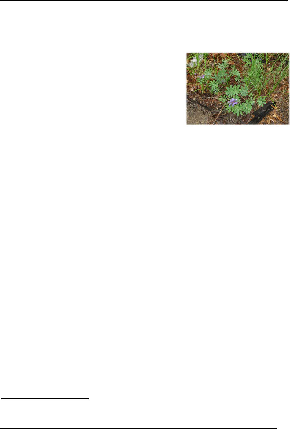
The only rare species confirmed to exist on the site is
the flowering plant wild lupine (Lupinus perennis). It
was located in the vicinity of the railroad north of Area C
(see Map 2). The species occurs in an area of remnant red
pine and appears to be healthy and self-sustaining. Rare
and or uncommon plant and animal species that have
potential to inhabit the site, as well as species identified
on the site, are listed in Appendices E and F.
IV. LAND USE PLAN
A. Existing Conditions
1. Land Uses
Before the site was acquired by the City of Nashua, the Pennichuck Corporation (PC)
managed the land for watershed protection and forestry purposes. In order to protect the water
supply, the City of Nashua and PC established protective buffers around all of the wetlands and
Pennichuck Pond (see Table 3). PC placed a 50-foot “no disturbance” buffer around all water
bodies prohibiting all activities including logging, and the construction of structures or trails. In
addition, all recreation activities are restricted within this buffer. The buffers are shown on
Map 4.
The site was also managed for timber harvesting. PC registered the site as a Certified Tree
Farm in order to generate revenue and apply for current use status for the property. In 1991, PC
contracted with Bay State Forestry Services to conduct a biomass harvest to completely remove
all crooked, defective trees, therefore ensuring the success of the remaining stronger, marketable
trees. In 2000 Bay State Forestry Services conducted another harvest on the site. This was a
conventional operation that harvested only mature trees, which were brought to several landing
areas on the property and hauled off-site. According to the forester from Bay State Forestry, a
sustainable harvest will not be available for another 15 years (2015).
2
Limited recreational activity occurs on the property as well. There are numerous logging
roads crossing the property and there is evidence that they are used for walking, horseback
riding, mountain biking and hunting. It is assumed that the site mainly serves residents in close
proximity because of the lack of adequate parking, the landlocked nature of the property, and the
restrictive natural resources (see “Current Access” section below).
2. Adjacent Land Uses
The site is surrounded by a variety of land uses (see Map 3). The majority of the land to the
north of the property is utilized for commercial and industrial purposes. Although much of NH
101A has been developed over the past 10 years, development continues along the northern
2
Conversation with Dan Cyr, Forester, from Bay State Forestry Services, November 2002.
Wild Lupine found at the
Northwest Sanctuary

Northwest Sanctuary Stewardship Plan
City of Nashua
January 2003
Page 8.
fringes of the site on Northwest Boulevard. A new office/light industrial building and the
Corning Lasertron building were recently constructed along Northwest Boulevard in 2000 and
2001, respectively. The retail store Target, located off Celina Avenue, will be completed by early
2003. There are also several warehouse buildings located on Capitol, State and Celina streets on
the northern side of the Guilford Industries Railroad that were built in the mid-1970s to early
1980s.
Guilford Industries serves as the northern border to the site. The railroad is still functional
and accommodates several runs for small freight loads per week. The tracks serve as a distinct,
physical barrier between two land uses in this area: heavy commercial and industrial uses on the
north side of the tracks and conservation on the south side. Because of the land uses on the
northern side and limited access on the south side, the site remains an unknown oasis along a
growing NH 101A Corridor.
The land uses to the east and south of the site consist of the Boire Field Airport and
residential properties. To the east is a relatively new subdivision in Nashua. To the southeast is
vacant land in Nashua. To the south of the vacant land is the border of Nashua and the Town of
Hollis, where much of the land is still farmed. At the southwest side of the site along Farley Road
are some single-family residences.
3. Current Access
Currently, there are few direct access points to the site due to surrounding private property,
the lack of direct frontage and restrictive natural factors. As shown on Map 3, private property
surrounds the site: the railroad to the north, the Boire Field Airport on the east, private
landowners to the southeast, and residential property to the south and east. The natural factors
restricting access are Pennichuck Pond to the west, the extensive wetland systems injecting the
site, and a dense vegetated layer along the cul-de-sac on Northwest Boulevard and the ASNH
property abutting Farley Road.
There are five access points from public roads or
property. The first two access points are from the western
ends of Massassoit Drive and Indian Rock Road (see Map
1). There is a traffic barrier at the end of a steep slope on
Massassoit Drive that intersects with Deerwood Drive.
Deerwood Drive is a Class VI road that runs north-south.
3
It is approximately 0.8 miles long and measures ten (10)
feet wide. To the north, the road begins at the
intersection with the North Fork of Blood’s Crossing
(Area D) and runs adjacent to the Boire Field Airport
and private property to the east and west respectively.
4
South of the intersection with Massassoit Road,
Deerwood Drive traverses private property, intersects with Indian Rock Road, and ends at the
border of Nashua and Hollis. A trail still exists in Hollis and continues to the intersection with
Pine Hill Road on John Gelazauskas’ property (Lot 39-1). However, according to the Hollis
3
Class VI roads are an important recreation resource. Class VI roads are public rights-of-way. They include all discontinued roads
subject to gates and bars, or any road that has not been maintained by the town in suitable condition for travel for five successive
years or more. Although towns have no duty to maintain them, Class VI roads are full public highways over which the public has a
right to pass at its own risk (Town of Hanover, Open Space Priorities Plan, 2000).
4
The actual legal length of Deerwood Drive is still under investigation. The stretch of Deerwood Drive from the railroad tracks to
the intersection with the North Fork of Blood’s Crossing was discontinued, according to City records, in 1985. Please see Appendix
H for additional information from the Nashua DPW.
Access points to site from Massassoit Drive and
Indian Rock Road

Northwest Sanctuary Stewardship Plan
City of Nashua
January 2003
Page 9.
Department of Public Works, Deerwood Drive
5
was discontinued from the Town line to the
intersection with Pine Hill Road at a Town Meeting in 1957. The opportunity to buy a right-of-
way may be possible and should be pursued if a future access point is desired.
The third access point is at the cul-de-sac on
Northwest Boulevard in Area A (see Map 1). This road
was built to provide access to the former Westwood
Property and the Corning Lasertron site. This is the
only existing access point to the site that has adequate
parking facilities. There are no trails connected to the
cul-de-sac at this time, however. In addition, any trail
that is constructed will necessitate a large wetland
crossing to connect Area B to the main part of the site at
Area D. This is discussed in more detail in the “Passive
Recreation and Watershed Protection” section below.
The fourth access point is the logging road off of Farley
Road (hereon the Farley Road logging trail) (see Map 1).
The trail is approximately 1.1 miles long and ten (10) feet
wide, and is in good condition. Due to its size and
condition, the Farley Road logging trail could provide an
excellent recreational facility.
The Farley Road logging trail serves as access to the
Bergeron Property, which contains a summer home on
Pennichuck Pond. The trail has also been used by PC for 11
years to access the property for forestry management. In
1997, the West Revocable Trust granted PC “a permanent
easement for the purpose of passing and repassing on
foot…upon and across the…premises between Farley Road and
land of Pennichuck Corporation…”.
6
Access rights were
transferred to the City of Nashua when PC sold the land.
The first half of the land adjacent to Farley Road logging trail (Lots I-48, I-49, and I-9) was
donated by the West Revocable Trust in 2002 ASNH. Access rights to the trail were transferred
to ASNH when the property was donated by Ms. West.
Parking
There are currently three (3) locations in the vicinity of the site where parking seems feasible.
The first location is on the north side in the cul-de-sac at the end of Northwest Boulevard. The
cul-de-sac can accommodate approximately ten (10) cars. This is also within a short walking
distance of several businesses and a shopping plaza.
The second location is along Farley Road adjacent to the entrance to the logging road. Farley
Road is a Class V road, and hence, has space for a car to park parallel to Farley Road safely on
either side of the road. This would also be an appropriate location for a bike rack.
5
Deerwood Drive is known as Blood’s Crossing Road in the Town of Hollis.
6
Easement Deed between Irene F. West and Pennichuck Corporation, page 1 of 3. Book 4485, Page 232 (see
Appendix G for full deed)
Access point to the site from NW Blvd
Farley Road Access to Site

Northwest Sanctuary Stewardship Plan
City of Nashua
January 2003
Page 10.
At the end of Massassoit Drive there is room for 2-3 cars to park straight in perpendicular to
a traffic barrier at the top of a steep slope. The road could be paved several feet past the traffic
barrier to provide adequate space for cars to park without blocking residential driveways.
However, the parking area is in close proximity to the driveways of the abutting landowners.
Signs with correct parking procedures need to be posted at the entrance. Also, the City should
discuss any plans for parking with the abutting landowners before implementing them and
develop a system for reporting any parking issues to the City. Additional consideration should
be given to whether or not to post the availability of parking availability at this site.
4. Existing Trail Network
The existing trail network (see Map 1) consists mainly of interconnected former logging roads
(hereon called trails). The trails are approximately ten (10) feet wide and are well-compacted and
fairly clear due to logging truck travel. The terrain is relatively flat with the highest points
reaching 200 to 210 feet. Hence, these trails will require very little maintenance as the foliage is
tamed to the sides of the trails and erosion will be limited due to the flat, compacted terrain.
The trails also offer a variety of wildlife viewing and educational
opportunities. On the Farley Road logging trail, visitors can
experience a rare Southern New England Level Bog and the natural
reforestation occurring after the various logging events that have taken
place. In addition, when visitors access the site they can enjoy
numerous passive recreational activities in areas outside of the 100-
foot buffer and wetlands.
There are also smaller trails within Areas G and H (see Map 1).
These trails were detected using aerial photography and the width,
exact length and condition are uncertain. Site visits are necessary to
confirm these characteristics. Although their exact condition is
uncertain, it is recommended that the trails be used for foot traffic only
because of the sensitive nature of the terrain.
The width, interconnection and terrain of many of the trails
could allow for a variety of simultaneous passive recreational uses, and the conditions make the
site an ideal location for both the beginner and avid outdoorsman.
B. Passive Recreation and Watershed Protection
1. Analysis of Impact Area
Easements and Restrictions
There were several easements and restrictions in place when this site was acquired. These
easements and restrictions must be considered when educating the public and designing,
constructing and maintaining the trail network. Table 3 summarizes the restrictions on the site.
Farley Road Logging Trail

Northwest Sanctuary Stewardship Plan
City of Nashua
January 2003
Page 11.
Table 3: Easements and Restrictions on the Northwest Sanctuary
Easement or Restriction Enforcement Entity
Motor vehicle access for water supply reasons only Deed from Marcia Poulin to ASNH
No ATV use Source Water Protection Grant
100-Foot buffer on all wetlands - 50-foot no-disturbance
zone, remaining 50 feet is limited vegetation removal
Pennichuck Corporation
300 foot buffer on Pennichuck Pond – 50-foot no-
disturbance zone, remaining 250 feet is limited vegetation
removal
Pennichuck Corporation
Audubon restrictions as they apply to access adjacent to
the site (see Appendix K)
Audubon Society of New Hampshire
300-Foot buffer on Pennichuck Pond and 150-foot buffer
on all wetlands associated with Pennichuck Pond
City of Nashua Water Supply Protection District
Sources: LCHIP Program, NH DES Source Water Protection Grant Program, Pennichuck Corporation, City of Nashua
Zoning and Subdivision Regulations, 2001.
Wildlife Habitat
One of the main objectives for the site is enhancement of the wildlife habitat that exists or has
potential to exist. The main concern in retaining and enhancing a sustainable wildlife habitat is
maintaining the contiguous upland and wetland features, as well as the structural diversity and
complexity of the vegetation along the property lines and zones of transition (e.g., upland areas).
Currently, there are large, undisturbed expanses of upland and wetland forested habitat in Areas
D, E, F, G, and I. These areas provide nesting and migratory habitat for the observed bird species
and those that have high potential to inhabit the area for all or a portion of the year (see Table 2
for wetland species). The upland areas need to consist of a heterogeneous mosaic of woodlands,
thickets, and herbaceous openings.
7
A 500-foot buffer is recommended along the adjacent upland habitat for the wetland species
observed or suspected to inhabit the site, especially in the
vicinity of Pennichuck Pond and Areas C and H (see Map
4). Seasonal restrictions on access during particularly
sensitive time, such as during turtle nesting (May-July) and
amphibian migration periods (early spring) should be
considered. Consideration of reptile habitat on the site is
also important. Areas of concern are: turtle basking sites
in Pennichuck Pond and Muddy Brook; potential turtle
nesting in Areas C, D, E, F, G, and I; and bedrock outcrops,
rock heaps and debris piles on south facing slopes in Areas
A, D, G, and F. Area H is also high in wildlife and wetland
functions and values due to its connectivity with Muddy
Brook and North Fork of Blood’s Crossing wetland systems.
In order to confirm the species that could be affected by various activities on the site, an
annual census of wetland birds at Pennichuck Pond and Muddy Brook and surveys for reptiles
and rare and sensitive mammals should be conducted.
7
Poole, E. Ann, Informal Ecological Assessment and Natural Resources Inventory of the Northwest Conservation Land,
Nashua, NH, October 2002.
Blanding’s Turtle

Northwest Sanctuary Stewardship Plan
City of Nashua
January 2003
Page 12.
Watershed Protection Concerns
The site serves as a water purification and filtration system for the Pennichuck Brook
Watershed. Nearly thirty (30) acres of the site are covered by two extensive wetland systems (see
“Natural Resources” section). These wetlands filter out non-point source pollutants including
sediments, nutrients, heavy metals, toxics, pesticides, pathogens and salt. In order for these
wetlands to function properly a 100-foot buffer was established by PC to reduce degradation
impacts. PC requires the first fifty (50) feet of the buffer to be a no-disturbance zone that must be
kept in its natural state. The remaining fifty (50) feet must be kept in a natural state, with some
limited clearing allowed. In addition, there is a 300-foot buffer around Pennichuck Pond, with
fifty (50) feet to be kept in a natural state with some limited clearing allowed (see Map 4).
In 1998, the City of Nashua adopted the Water Supply Protection District as part of the
Nashua Zoning Ordinance (see Appendix I). These zoning regulations are intended to protect
the water supply through buffer zones applied to the Pennichuck Pond and its associated
wetlands. The regulations establish a Conservation Zone that “shall consist of all land areas
located within three hundred (300) feet of the annual high water mark of ….Pennichuck Pond,
and all land areas located within one hundred fifty (150) feet horizontally from all water bodies
that are connected via surface water to the aforementioned ponds and the wetlands associated
with those water bodies.”
8
All uses are prohibited in the Conservation Zone.
The main threats to the wetlands on the property are increased flooding, sedimentation, and
point and non-point source pollutant loads, including nutrients, suspended solids and organic
matter. Changes in the hydrology may increase the duration and depth of water in the wetlands
and Pennichuck Pond. Among other concerns, an increase in flooding can: increase mortality of
shrubs and trees in swamps due to standing water, change the species composition in the
wetlands, and reduce public access.
The main activities that can affect the hydrology on the site and are generally of concern for
watershed protection are: 1) maintenance and construction of new trails; and 2) the use of
bicycles, especially in areas of steep slopes and in the vicinity of wetlands or at wetland crossings.
These activities could increase the amount of sediment the wetland receives due to erosion. In
addition to sedimentation and erosion, maintenance and construction near wetlands could result
in excessive removal of vegetation in the buffer or possibly improper disposal of the vegetation
removed into sensitive areas. Use of bicycles on the property can raise concern regarding
diversions from the trail as bicyclists sometimes wander off the designated trails.
Allowing recreational uses, especially bicycles, in sensitive areas could subject the wetlands
to unnecessary disturbances. At a minimum, the City should consider restricting certain uses,
such as bicycles, to specific trails and/or designing trails to discourage unwanted disturbances
off the trail surfaces (see “Proposed Trails” section below). Designing trails to keep all visitors on
the trails can be accomplished with physical barriers, grading, plantings and signs discouraging
“cutoffs” from the trail.
9
Whichever methods are used, the passive recreational uses established
on the site should not conflict with the primary goal of watershed protection.
There are four (4) areas, in particular, where activities should be restricted: 1) the area where
the Farley logging road crosses the Muddy Brook wetland system on the ASNH property; 2) the
8
City of Nashua, City of Nashua Zoning and Subdivision Ordinances, Revised January 23, 2001. Article X, Section 16-
653, page 1235.
9
Rails-to-Trails Conservancy, Trails for the 21
st
Century – Planning, Design, and Management Manual for Multi-Use Trails,
1993.

Northwest Sanctuary Stewardship Plan
City of Nashua
January 2003
Page 13.
southernmost point on the trail through Area F; 3) the wetland crossing from Area B to Area D;
and 4) the North Fork of Blood’s Crossing wetland trail crossing in Area D. Table 4 outlines these
areas, the resource at risk, and the activities that should be limited in these areas.
The most notable area of concern on the site is the wetland crossing from Area B to Area D.
This area is just upstream of the heart of the North of Blood’s Crossing wetland system. It is
estimated that in order to provide access from Area B to Area D, a 175-200 foot elevated
boardwalk will be required. If allowed, bicycle use in this area should be restricted to the
immediate trail with railings constructed approximately one hundred (100) feet before and after
the boardwalk, in addition to along the boardwalk itself.
There are tentative plans to construct an education center on the Audubon land. According
to the City of Nashua and PC buffer regulations, no structures can be built within the buffer zone
(300-feet adjacent Pennichuck Pond, and up to 150 feet on the wetlands). In addition, according
to Mike Milligan, the Sanctuary Steward for ASNH, no structures are allowed on parcels with
SPNHF easements. If other locations are being researched on the site, it should be noted that the
forty-one (41) acre conservation easement (Area I) acquired from the Pennichuck Corporation
expressly prohibits that any “structure or improvements…be permanently or temporarily
constructed, placed or introduced onto, above, or below ground on the Property.”
10
Table 4: Restricted Activities in Watershed Protection Areas
Area Resource at Risk Restrictions to Activities
Wetland Crossing on Farley Road logging
trail on ASNH Land
Muddy Brook Wetland
· Limited vegetation cutting
· Signage to keep bikes on the trail
· No fill to widen the trail
· Signage to alert visitors of wildlife
migration in the spring
Western tip near the 1
st
lookout on the
Loop Trail (Areas F and G)
Southern New England Level
Bog
· No bicycles (install physical barriers)
· Limited clearing
· Signage to alert visitors of wildlife
migration in the spring
Wetland crossing from Area B to Area D North Fork of Blood’s Crossing
Wetland
· Railing on the boardwalk crossing the
trail and 100 feet on either side of the trail
· Physical barriers to prevent wanderers
· Limit the boardwalk width to six feet
· Signage regarding the sensitivity of this
area and significance to Pennichuck
Watershed
· Signage to alert visitors of wildlife
migration in the spring
Trail crossing wetland in Area D North Fork of Blood’s Crossing
Wetland
· Limited vegetation cutting
· Install a series of elevated boardwalks
· Signage to keep bikes on the trail
· Signage to alert visitors of wildlife
migration in the spring
Sources: Poole, E. Ann, Informal Ecological Assessment and Natural Resources Inventory of the Northwest Conservation Land,
Nashua, NH, October 2002.
City of Nashua Zoning and Subdivision Ordinances, Revised January 23, 2001. Article X, Section 16-653, page 1235.
10
Conservation Easement Deed between Westwood Park, L.L.C. and the City of Nashua, page 4 of 16. Book 6516,
Page 698

Northwest Sanctuary Stewardship Plan
City of Nashua
January 2003
Page 14.
Proposed Trails
Trail design, construction and maintenance should reflect an awareness of, and respect for,
the site’s qualities and the overall purpose of water supply protection. Trail locations and design
should be simple and not detract from the predominant sense of a natural environment. This
can be accomplished by: 1) aligning the trails with the natural topography of the land and
ensuring that water does not collect on the trail surface; 2) confining the trail corridor clearing to
within two (2) feet of the trail and backslope edges; and 3) keeping average trail grade to 8% or
less.
11
These practices will ensure appropriate trail design and will require a minimal amount of
maintenance in the long run. The number and length of the trails constructed should also be
considered; numerous, lengthy trails will require more maintenance, and therefore, more human
and monetary resources.
Consideration should be given to the potential conflict between various users on the site. Of
particular concern is the potential for mountain bikes to compromise trail safety and increase
user conflict. Due to the sensitive nature of the property, it is not recommended that the trails be
designed for the rugged, challenging trail experience that some mountain bikers seek. Instead,
educate visitors, especially bicyclists, about proper trail uses such as: 1) riding only on open
trails; 2) yielding the right of way to other users; and 3) taking care not to scare wildlife. A calm,
peaceful environment should be created through grading and plantings. Maintaining
intersections to prevent potential collisions between users may also encourage appropriate use of
the site. Table 5 summarizes the allowed uses on the site, the areas these uses are restricted to,
and the possible impacts of each of these uses.
Despite the extensive wetland systems and otherwise sensitive nature of the site, there are
several logging roads (see Map 1) that allow for extension trails to be built to create a loop system
or bring visitors to special “look-out” spots. Three (3) trail systems were recommended for the
site by E. Ann Poole: 1) the Loop Trail; 2) the North Fork of Blood’s Crossing Trail; and 3) the
Connector Trail. These three trails will need to be confirmed in the field and flagged. All three of
these trails will require wetland crossings. In addition, access to the Loop Trail may need to be
restricted in the spring due to its proposed location through the recommended 500-foot wildlife
habitat corridor (see “Wildlife Habitat” section). The proposed Loop Trail location may need to
be reconsidered altogether due to the current intrusion into several of the buffer zones (see Map
4).
The Loop Trail: The Loop Trail would stem from the
Farley Road logging trail in Area F (see Map 1).
Approximately five hundred (500) feet north of the
ANSH property line, the trail would head west, following
the contours, into Area G, and then north to Area I. The
trail would follow the contours in Area I at the top of the
site and loop back south into Area E and meet with the
Farley Road logging trail again. The entire length of the
trail, as proposed, would be 1.9 miles.
The Loop Trail would have four lookout points: 1) one in
Area F that views the south part of the property,
including the Southern New England Level Bog; 2) one in
Area G which also views the Southern New England Bog;
and 3) two in Area I that view Pennichuck Pond and the
11
Arrowhead Trails, Inc. - http://www.arrowheadtrails.com/
8’
Clearance
4’ Clearance
Example of a trail corridor
designed for foot traffic

Northwest Sanctuary Stewardship Plan
City of Nashua
January 2003
Page 15.
interior of the site respectively. Due to the proximity of the proposed trails to the Bog
and the sensitivity of the terrain, mountain bikes are not a recommended use on the Loop
Trail. Physical barriers should be installed at the entrances to the trail off the Farley Road
logging trail (see Map 1). Clearing the trail corridors to 3 to 4 feet wide and 6 to 8 feet
high would help maintain a walker-friendly trail. Narrower trails, however are quickly
closed by encroaching vegetation.
12
This trail was recommended by E. Ann Poole in her
report, Informal Ecological Assessment and Natural Resources Inventory of the Northwest
Conservation Land, Nashua, NH.
The North Fork of Blood’s Crossing Trail (NFBC Trail): Access from this trail would
begin at Massassoit Road or Indian Rock Drive and head north on Deerwood Drive. At
the intersection of Deerwood Drive and the North Fork of Blood’s Crossing the trail
heads southwest. There are two trails that will take visitors to the end-point. The first
trail is an old logging road that intersects the North Fork of Blood’s Crossing after
crossing over the wetlands. The second trail is before the downed Elm tree. The trail
ends with a lookout point with a view of the Unnamed Tributary to Pennichuck Brook.
The entire length of this trail would be approximately 1.65 miles.
This trail would require a series of boardwalks (possibly 6 or 7) after the intersection with
Deerwood Drive (see Map 1) to accommodate the North Fork of Blood’s Crossing
wetland system. The trail is relatively flat, with a slight decline at the entrances from
Massassoit and Indian Rock Drives. This trail could be multi-use, as long as the wetland
areas are protected against wandering visitors (a.k.a…wanderers). This can be done
through the installation of physical barriers such as railings (see picture), grading and
plantings. A wetland delineation and permit will be required to place a boardwalk or
construct any other physical barrier in the wetlands. This trail was recommended by E.
Ann Poole in her report, Informal Ecological Assessment and Natural Resources Inventory of
the Northwest Conservation Land, Nashua, NH.
Potential Trails and Connections
In addition to the aforementioned trails, there are several other possibilities on the site.
However, two of these trails, the Connector and the ASNH Trail from Farley Road, would
require significant wetland crossings. Due to the sensitive nature of the adjacent wetlands, if the
City proceeds with construction of these trails consideration should be given to whether bicycles
should be allowed.
A trailhead to the site should also be considered. The best site for a trailhead is the access
gate to the Farley Road logging trail. There is a 50-foot access easement along the Farley Road
logging trail that ends at the intersection with Farley Road. Pending negotiations with ASNH
and PC, the gate at the entrance to the Farley Road logging trail could be pushed back about 5-6
feet, which would make room for about eight (8) cars. Additional parking is also available along
Farley Road.
12
University of Minnesota Extension Service - http://www.extension.umn.edu/

Northwest Sanctuary Stewardship Plan
City of Nashua
January 2003
Page 16.
The Connector Trail: This trail will begin at the
cul-de-sac at Northwest Boulevard and follow
the property lines in Area B (see Map 1). At the
North Fork of Blood’s Crossing wetland a 200-
300 foot elevated boardwalk will be required to
connect Areas B and D. The City of Nashua
was granted a 50-foot wide access easement
across the wetland. The trail would connect
with the North Fork of Blood’s Crossing Trail
on the south side of the wetland. The trail, as
proposed, would be 0.3 miles long. It is
recommended that in order to prevent people
from wandering off the trail, it should be
designed with grading, plantings, signs and/or
railings placed one hundred (100) feet before and after the boardwalk and on the
boardwalk itself (see picture above). Also, due to the sensitive nature of the wetland, the
width of the boardwalk should be limited to six (6) feet to encourage bicyclists, if
allowed, to walk. A wetland delineation and permit will be required to place a
boardwalk through the wetlands.
ASNH Trails: ASNH has indicated a strong interest in coordinating future trail
connections with the City of Nashua. One possible trail connection is on the ASNH land
abutting Farley Road. This would require a significant wetland crossing (approximately
300 feet), however. A wetlands delineation would need to be performed to confirm this
estimate, and a permit from NHDES is necessary to construct the trail.
101A Trail Connection: A potential connection from the site to a proposed regional trail
network exists near the railroad crossing on Northwest Boulevard. The Nashua Regional
Planning Commission’s Route 101A Corridor Master Plan and Improvements Program, 2002,
recommends a shared-use trail for bicyclists and pedestrians adjacent to the railroad
right-of-way between NH 122 in Amherst and Charron Avenue in Nashua.
Forest Management
13
The site has been managed as a Certified Tree Farm since 1991 by
Bay State Forestry Services. The certification requires the development
of a forest management plan that outlines methods for the long-term,
sound stewardship of the parcel. The plan needs to consider the four
principles of the American Forest Foundation Tree Farm Program:
management for wood, water, wildlife and recreation. The landowner
must prove that they are motivated by a land ethic that embraces
wildlife, aesthetics, thriving forests and healthy watersheds.
Landowners who wish to become certified tree farmers must allow their property to be
inspected by a forester. If the property meets standards set by the American Forest Foundation
the landowner receives a certificate, a “Tree Farm sign,” and enrollment in the American Tree
Farm System. Properties must then be re-inspected every five years to maintain their status.
The Pennichuck Corporation recertified the site in 1999. Once a property is sold, it needs to
be recertified. After the sale is complete, a one-year probation period is required before the new
13
This section is based on a conversation with Dan Cyr, Forester, from Bay State Forestry Services, November 2002.
Elevated Boardwalk with railing over
wetlands. Courtesy of the Potomac River
Public Access Plan, Middle Peninsula
Planning District Commission

Northwest Sanctuary Stewardship Plan
City of Nashua
January 2003
Page 17.
landowner can petition for recertification. A new forest management plan will be required before
the land can be recertified under the American Tree Farm System.
It is recommended that the City pursue the necessary resources to develop a new forest
management plan for the site. Managing the site for a mix of forest ages will encourage a more
stable ecosystem that is less susceptible to disease, fires, exotic species and extreme weather
conditions.
14
A healthy managed tree stand will allow for slow, but sustainable infiltration of
water into the soil. This will slow soil erosion rates, protect water quality and ensure a greater
rate of groundwater recharge. A sustainable harvesting plan, which includes conservation
management practices, needs to be developed for the site to ensure that water quality and
quantity is protected.
15
Issues to consider and include in a forest management plan are:
16
1) Time forest management activities to occur during the fall and winter months so as
to minimize disturbances to wildlife, soil and vegetation.
2) Limit clear cutting and propagation of monocultures. Maintain habitat diversity by
allowing/encouraging the forest understory to remain complex.
3) Avoid fragmenting woodlands through careful placement of roads and other barriers
to wildlife movement and protect unique habitat features, such as isolated wetlands,
within the forest.
4) Discourage logging in swampy areas where trees are small. Swamps and riparian
areas should be disturbed as little as possible.
5) Where openings or log landings exist, maintain the open nature of the area. Promote
native warm-season grasses and avoid excessive compaction and erosion by
pedestrians.
6) Forest value in order to enhance for wildlife and watershed protection. Leave tree
butts, branches and other fallen woody debris in place to decay rather than clean
them up. Litter layer dissipates the energy contained in raindrops and maintains a
porous soil surface and high water infiltration rates; consequently, overland flow is
minimized in the forest.
17
2. Uses and Limitations
One of the intended uses of the site is passive recreation. LCHIP and NH Department of
Environmental Services (NHDES) limit certain activities on land protected with grant funds.
Activities which are allowed are: hiking, cross country skiing, bicycling, and other non-
motorized recreation. Fishing and non-motorized boating are also allowed on much of the land
conserved under the LCHIP program; however, because of the buffers imposed by Pennichuck
and the City of Nashua (see Table 3), fishing and boating are not allowed on Pennichuck Pond,
Muddy Brook or the associated wetlands. The NHDES Water Supply Grant Program does not
allow horses or other livestock, docks, camping, fires, all-terrain vehicles, motorized watercraft or
other motorized recreational vehicles.
18
The City of Nashua’s Water Supply Protection District
Regulations prohibit all uses in the conservation area (see “Watershed Protection Concerns”
14
Paul Barten, Forester and Associate Professor at the University of Massachusetts, Amherst, December 2002.
15
Massachusetts District Commission, Wachusett Reservoir Watershed Land Management Plan: 2001-2010, August 2001.
16
Poole, E. Ann, Informal Ecological Assessment and Natural Resources Inventory of the Northwest Conservation Land,
Nashua, NH, October 2002.
17
USDA Forest Service Southern Research Station and Southern Region, Southern Forest Resource Assessment, October
2002. http://www.srs.fs.fed.us/sustain/report/aqua1/aqua1.htm#TopOfPage
18
NHDES Water Supply Grant Program, Permitted Uses and Activities, 2001

Northwest Sanctuary Stewardship Plan
City of Nashua
January 2003
Page 18.
section). The City’s intention of this zone is to ensure that it is “maintained as an undisturbed
buffer for the purpose of protecting the drinking water supply.”
19
The ASNH developed Sanctuary Rules and Regulations for all property owned outright or that
they hold easements on (see Appendix J). These regulations are consistent with the allowed uses
and limitations currently placed on the site. The one main difference is that ASNH erects signs
that state “No Hunting” on some of their properties. This is not considered a legal posting,
however, so ASNH acknowledges that hunters should be discouraged, but hunting may occur.
ASNH does not allow camping, fires, horseback riding, motorized vehicles, pets without a leash,
picking of vegetation, powerized boats, snowmobiles, swimming or trapping. Mountain bikes
are allowed, but not on single track paths. ASNH limits mountain bike access to public right-of-
ways such as Class VI roads and railroad beds. This standard seems appropriate for the site as
well.
Table 5 below outlines the uses and potential impacts of these uses on the site in order of
impact. These are based on the allowed uses set by the LCHIP and Water Supply Grant
Programs, the recommendations from E. Ann Poole, the City of Nashua’s Water Supply
Protection District regulations and PC’s buffer regulations. These activities and potential impacts
need to be monitored and evaluated for potential long-term impacts.
19
City of Nashua, City of Nashua Zoning and Subdivision Ordinances, Revised January 23, 2001. Article X, Section 16-
653, page 1235.

Northwest Sanctuary Stewardship Plan
City of Nashua
January 2003
Page 19.
Table 5: Uses on the Northwest Sanctuary and Potential Impacts
Uses Limitations Potential Impacts
Impact
Rating
Mountain
Biking/Biking
Must stay on the following Class VI
roads: Farley Road logging trail,
North Fork of Blood’s Crossing and
Deerwood Drive outside the City of
Nashua Conservation Zone
· Trail wanderers causing
erosion
· Habitat destruction
· Littering
· Wetland impacts
High
Dog Walking Designated trails in all Areas and
outside the City of Nashua
Conservation Zone
Must be on a leash at all times
· Dogs defecating in wetland
areas and/or buffers
· Wildlife disturbance
· Habitat destruction
· Pick up waste per City of
Nashua Ordinance
Medium
Orienteering Designated trails in all Areas except H
and C and outside the City of Nashua
Conservation Zone
· Orienteers wandering off the
designated trails causing
erosion, habitat destruction
· Littering
Medium to
Low
Hunting All Areas except H and C, during
specified hunting seasons only.
· Habitat destruction
· Wildlife disturbance
· Littering
· Recreation Safety
Low
Cross Country Skiing Designated trails in all Areas except H
and C, and outside the City of Nashua
Conservation Zone
· Trail wanderers which may
destroy habitat
· Littering
Low
Hiking Designated trails in all Areas except H
and C and outside the City of Nashua
Conservation Zone
· Trail wanderers causing
erosion, habitat destruction
· Littering
Low
Snowshoeing Designated trails in all Areas except H
and C, and outside the City of Nashua
Conservation Zone
· Trail wanderers which may
destroy habitat
· Littering
Low
Nature Watching
Designated trails and lookout points
in all Areas except H and C and
outside the City of Nashua
Conservation Zone
· Trail wanderers which may
disturb and/or destroy habitat
Low
Source: LCHIP, Stewardship Guidelines and NHDES, Water Supply Grant Program.
3. Opportunities for Land Acquisition and Access
The Open Space Committee, an adjunct committee of the Nashua Conservation Commission,
is dedicated to obtaining more information about parcels for acquisition adjacent to the
Northwest Sanctuary. In early 2002, the Committee approached the Tamposi Family about
acquiring three parcels of their land with grant funds from LCHIP and the NHDES Source Water
Protection Grant Programs (see Map 3). These parcels are located on the southeast side of the site
and would provide an additional 101 acres to the site. Obtaining these parcels could also provide
more direct access from Massassoit and Indian Rock Roads to the site via Deerwood Drive.
However, access to the land is severely limited by the headwaters to the North Fork of Blood’s
Crossing wetland system. It is recommended that limited, if any, trail construction occur on the
parcels. If access is made available, the City should limit visitors to the summer months (June –
August). This would ensure that wildlife habitat in the wetlands would not be disturbed in the
spring and may eliminate the need for significant wetland crossings.

Northwest Sanctuary Stewardship Plan
City of Nashua
January 2003
Page 20.
V. STEWARDSHIP OPTIONS
Acquisition of the Northwest Sanctuary signifies an important step in conserving land in the City
of Nashua. The City does not currently have a method for managing conservation land. The goal of this
section is to assist decision-makers in developing a stewardship model that is both applicable and
appropriate for the City of Nashua. In order to find that model, various stewardship plans were
researched throughout the State and nationwide in order to develop a stewardship model that can be
used for conservation land purchased by the City in the future.
This chapter presents a summary of the stewardship components necessary to protect and
manage open space, such as staff and volunteer resources, funding and education. Examples of each
component found throughout New Hampshire, Massachusetts and nationwide are provided in bulleted
format.
A. Identification of Stewardship Organizations
1. Staff and Volunteer Resources
According to Marjory Swope, Executive Director of the New Hampshire Association of
Conservation Commissions, most of the commissions in the state serve as the stewardship
organization for municipally-owned conservation land (including town forests, open space,
water supply land, etc.). Under RSA 36-A:4 – Powers of a Conservation Commission (see Appendix
K), “said commission may acquire in the name of the town or city, subject to the approval of the
local governing body, by gift, purchase, grant, bequest, devise, lease, or otherwise, the fee in such
land or water rights, or any lesser interest, development right, easement, covenant, or other
contractual right including conveyances with conditions, limitations or reversions, as may be
necessary to acquire, maintain, improve, protect, or limit the future use of or otherwise conserve
and properly utilize open spaces and other land and water areas within their city or town, and
shall manage and control the same…”. Further, RSA 36-A:2 states that the commission is
established to ensure the, “proper utilization and protection of the natural resources and for the
protection of watershed resources of said city or town.”
Communities establish dedicated conservation funds to hire a staff person and/or provide
the other resources needed to ensure the long-term protection of conservation land. In the
Nashua Region, the Conservation Commissions in the following communities serve as the
stewardship organization: the Towns of Amherst, Brookline, Hudson, Litchfield, Lyndeborough,
Merrimack, Milford, Mont Vernon and Pelham (through an Open Space Committee).
20
In
Massachusetts, many Conservation Commissions allocate money to hire support staff.
Regardless of whether it is a volunteer or paid staff, however, research has found that the
Conservation Commission is the lead organization in managing conservation land in most
communities.
· Amherst, NH: The Nashaway Chapter of the Audubon Society serves as the steward of the
Ponemah Bog Conservation Area. They monitor the land and communicate any problems to
the ASNH.
20
This list was obtained through conversations and internet searches in each of these communities. These
commissions all clearly state that their mission is the preservation and management of open space in their respective
communities.

Northwest Sanctuary Stewardship Plan
City of Nashua
January 2003
Page 21.
· Hanover, NH: The Conservation Commission created a Land Conservation Committee
which includes Commission members and other local officials, as well as residents and
representatives of the Upper Valley Land Trust, Hanover Conservation Council and
Appalachian Trail Land Trust. The Land Conservation Committee works under the
supervision of the Commission, and any recommendations are fully reviewed by the entire
Commission. Recommendations to the Board of Selectmen for commitment of Conservation
Fund monies are made by the full Commission. The Land Conservation Committee should:
- encourage, propose and develop open space protection projects;
- evaluate projects in which the town might become involved;
- report recommendations to the Conservation Commission;
- establish standards for conservation easements to be granted to the town;
- protect from development parcels without maintained public road access and parcels
which rely on Class VI road frontage;
- fill in missing links between existing protected open space lands and trail segments,
between in-town and rural open spaces, and between trail segments; and
- maintain an active relationship with local, regional and statewide land trusts.
· Concord, NH: The Concord Conservation Commission is the stewardship organization for
conservation land. Its mission is “to promote, protect, manage, and develop for public use,
the natural resources of the City of Concord.” A subcommittee of the Conservation
Commission, which is comprised of commission members as well as non-commission
members, oversees specific issues relating to construction, maintenance, funding, etc.
Anything over five (5) acres in the town is part of the Town Forest and, hence, under the
jurisdiction of the Conservation Commission.
In 2002, Concord hired an AmeriCorps Member out of the forestry fund (see “Funding”
section below) to coordinate trail volunteers/efforts. The Forestry Fund has an annual
budget of projected income and expenditures approved by the City Council as part of the
regular annual budget adoption procedure.
· Lincoln, MA: The Town of Lincoln has several paid staff to assist the Conservation
Commission, one of which is a land manager dedicated solely to management of
conservation land. The land manager oversees 1,700 acres of land in Lincoln. He is assisted
by seasonal rangers that are hired by the Conservation Commission. The rangers assist with
educational programs and trail construction and maintenance in the summer time. The
budget is tax-based and was approved at the 2002 Town Meeting for $160,000.
21
B. Monitoring
Regular inspection and documentation of the conditions on the land is an important stewardship
component. An established monitoring program to collect this information is important for several
reasons:
22
1. To catch violations. Open space is a target for illegal activities (dumping), built structures,
encroachments on the wetlands, etc.
21
Conversation with Tom Gumbart, Conservation Administrator, Town of Lincoln, MA, 2002.
22
Land Trust Alliance, Trust for New Hampshire Lands, The Conservation Easement Stewardship Guide – Designing,
Monitoring, and Enforcing Easements. 1991.

Northwest Sanctuary Stewardship Plan
City of Nashua
January 2003
Page 22.
2. To build rapport with property owners. Monitoring offers an opportunity to foster
cooperation with landowners. Regular monitoring visits provide the chance to educate,
answer questions, discuss problems, and avoid violations.
3. To save time and money. Monitoring can detect a violation before it becomes a serious
problem that may require legal action.
4. To provide a record in case of court action. If a violation occurs and is brought to court,
documentation from monitoring helps underline the credibility of the stewardship
organization. It also helps to determine adequate restoration or resolution of the
violation.
5. To satisfy LCHIP requirements. For any land purchased with LCHIP grant funds, the
property condition must be monitored and documented once a year.
In order to make monitoring effective, however, baseline documentation needs to be recorded.
Baseline documentation collects important data about the existing condition of the property when it is
acquired, including the physical layout of the land (trails, landmarks, etc.) and the legal layout of the land
(boundaries). The stewardship organization needs to have a thorough boundary survey done of the
conservation land. The boundaries need to be marked clearly at important, visible locations by an
engineer or land surveyor. Funds need to be designated for this purpose. The boundary markers should
be photographed, recorded and noted on a map so that the monitoring personnel can locate them easily.
A schedule needs to be established for monitoring. Depending on the type of public access
allowed, the land may need to be inspected frequently to check for hazardous conditions, vandalism or
abusive activities. It is recommended by the Land Trust Alliance and Trust for New Hampshire Lands
that conservation land be monitored at least seasonally.
The Society for the Protection of New Hampshire Forests has developed a method for monitoring
easements that can be adapted for conservation land owned outright. A sample monitoring document
that was altered for use by the City of Nashua is included in Appendix L.
· Hanover: The Conservation Commission works with the Land Conservation Committee to
foster volunteer stewardship efforts to monitor town-held easements annually, and to
maintain trails and open space lands.
C. Enforcement
A method of enforcing the appropriate uses on conservation land needs to be established in order
to discourage the improper use of the property. A variety of enforcement techniques have been
implemented, including Conservation Land ordinances and Commission enforced rules and regulations.
· Concord, NH: In order to regulate uses on town-owned conservation land, the City of
Concord passed a Conservation Land Ordinance. The ordinance restricts certain activities on
any conservation land, which consists of “all land within and owned by the City and
subject…to management and control by the Conservation Commission.”
23
(see Appendix M
for the full ordinance). By adopting these regulations, any violation can be reported to the
Concord Police, who can take immediate action. For additional benefits of these regulations,
please see the “Trail Construction and Maintenance” section below.
23
City of Concord, NH Code of Ordinances, 2002.

Northwest Sanctuary Stewardship Plan
City of Nashua
January 2003
Page 23.
· Lincoln, MA: The Town has established rules and regulations for the Town-owned
conservation land. These are posted at the site and in the Conservation Commission office
and printed on trail maps. Police have the authority to enforce these regulations on
conservation land, although they are not called upon regularly. The seasonal rangers that are
hired by the Commission have the power to police and authority to write tickets. However,
these rangers are more focused on training and education on the conservation land than
enforcing regulations through ticket writing.
The Town also regulates the use of conservation land by groups of 10 people or more. The
group must register for a use permit in order to use any conservation land. This ensures that
the rules and regulations will be given to all visitors in the group to avoid violations. The
Town charges a minimal fee for the permit (except to non-profit organizations).
D. Resolution of Conflicts
There are various issues, such as dumping and misuse, that could arise on conservation land. A
system should be established by the stewardship organization to resolve such issues as they occur. In the
absence of an established, regular monitoring program, the organization could encourage trail users and
neighbors to monitor and report maintenance problems. An “Improvement Request Form” could be
developed and placed at trailheads or entrances to the land with a contact name, address and phone
number of someone in the City. A field crew or staff from the City DPW could use these forms to
investigate the problem.
24
A direct line of communication should be established between the Legal
Department, the Community Development Division (Conservation Commission), the Police Department
and the Department of Public Works.
The stewardship organization could also develop a method for tracking citizen complaints. A
complaint/request form could be developed that includes the date, person’s name, daytime phone
number, and the location and nature of the problem (with pictures, if possible).
One problem that may occur on conservation land is dumping. Landowners may dispose of their
lawn clippings and other unwanted items (old car parts, drums, etc.). One way to discourage this is to set
clear boundaries (with signs, boulders, etc.) between the trail and private property, and to make them
known to all landowners.
25
Also, make the allowed uses on the land public knowledge. This can be done
through the media, educational programs, and letters to landowners and adjacent businesses. If the
problems persist, fines for violations or even legal action may be required.
E. Partnerships
Partnerships are crucial to achieve the goals set forth for conservation land. Partners have access
to resources that are not readily available to stewardship organizations. There are a number of
organizations that could/should be involved with the stewardship of conservation land in Nashua:
24
Rails-to-Trails Conservancy. Trails for the 21
st
Century – Planning, Design, and Management Manual for Multi-Use
Trails. 1993.
25
Rails-to-Trails Conservancy. Trails for the 21
st
Century – Planning, Design, and Management Manual for Multi-Use
Trails. 1993.

Northwest Sanctuary Stewardship Plan
City of Nashua
January 2003
Page 24.
Table 6: Partnerships for Conservation Land
Partner Potential Role
Nashua Conservation Commission Coordination of volunteers, members may sit on steering
committee for conservation land, oversee activities on
conservation land
Audubon Society of New Hampshire Collaboration on uses of conservation land, educational
resource
Society for the Protection of New Hampshire’s Forests Collaboration on uses of conservation land, education
resource
City of Nashua Urban Trails Alliance Coordination on the design, construction and maintenance
of trails on conservation land
Nashua Police Department Enforcement of regulated uses on conservation land
Nashua Parks and Recreation Department Use of Park Rangers for routine inspections, trail
construction and maintenance equipment and manpower
Department of Public Works Further manpower and equipment for maintenance and
construction
National Parks Service – Rivers, Trails, and
Conservation Assistance Program
Assistance with trail design, construction and maintenance
issues.
NH Department of Environmental Services Various departments to assist with technical issues (water
quality/supply, groundwater, invasive species, wetland
buffers, etc.)
Landowners Watchdogs, Adopt-A-Trail participants, subcommittee
participants
Businesses in the vicinity Watchdogs, Adopt-A-Trail participants, financial
supporters
Source: Compiled from a list of resources statewide. NRPC, 2002.
F. Trail Construction and Maintenance
Land that is purchased with LCHIP and NHDES Water Supply Protection grant funds require
public access to the property. This is usually done in the form of trail networks. The construction and
maintenance of trails requires dedicated resources (people, equipment and money) to ensure they are
constructed properly and that the trail is safe. Communities use volunteer and paid resources to
construct and maintain trails that are safe and accessible. In some cases, a local conservation corps or
summer youth program has been used to encourage stewardship and educate youth. The stewardship
organization could organize a bi-yearly clean-up/walkabout to remove debris, clean up trash, and
maintain the trails (such as the Mine Falls Park clean-up days). The City of Nashua employees could be
enlisted to participate, as well. The two events could be scheduled in the early spring (April) and in
September to satisfy LCHIP grant requirements.
There are dedicated Park Rangers working in the City of Nashua every summer that could also
be enlisted to monitor conservation land on a routine basis. Coordination with the Parks and Recreation
Department is necessary to involve the Park Rangers.
The following trail construction and maintenance issues should be addressed on a yearly basis:
26
- Signs and Traffic Markings – Install and inspect signs and keep them in good condition.
Make sure trail markings are clear and prominent.
26
Rails-to-Trails Conservancy. Trails for the 21
st
Century – Planning, Design, and Management Manual for Multi-Use
Trails. 1993.

Northwest Sanctuary Stewardship Plan
City of Nashua
January 2003
Page 25.
- Sight Distance and Clearance – Do not allow sight distances, especially those leading to
trail intersections and curves on multi-use trails, to be impaired by vegetation. Trim
trees, shrubs, and tall grass minimally, but enough to ensure the safety of the visitors.
Also, maintain adequate clearance on the sides of the trail and overhead. Trim tree
branches to allow room for seasonal growth.
- Surface repair (including boardwalks) and drainage – repair any trail damage from
seasonal washouts and silt or gravel washes. Repair potholes and remove ruts.
- Litter – annual clean-ups to remove waste from people. Post signs to inform visitors of
trash receptacle locations.
· Hanover, NH: The Conservation Commission:
- fosters volunteer stewardship efforts to monitor town-held easements annually and to
maintain trails and open space lands;
- encourages establishment of new trails as appropriate;
- develops a program to protect trails on town conservation lands from degradation,
including offering education programs and posting standards for restricting the use of
mountain bikes and other wheeled vehicles.
· Concord, NH: The Conservation Commission established an Adopt-A-Trail program. In the
absence of a staffed organization, a subcommittee within the commission enlisted friends,
solicited neighbors, scout troops, Boys and Girls Club, AmeriCorps programs, City
Departments (i.e., Parks and Recreation) and schools to be stewards of the area. Participants
are responsible for scheduled clearing and monitoring days (such as New Hampshire Trails
Days).
In addition, Concord adopted a Conservation Land Ordinance (see above in the
“Enforcement” section) which enlists the assistance of the Department of Public Works. The
DPW can be called upon to respond to emergencies that are beyond the purview of
Stewardship Organization (i.e., a downed tree, flooded trail or road, large waste items).
G. Publicity and Signs
Publicizing and posting allowed uses and restrictions is critical to achieving the goals for
conservation land. The initial task is to determine how much publicity is required. The type and amount
of publicity and signage will depend on the priorities for the land, the uses that are allowed, and the
audience. By using the media, signs on the property, educational programs, and letters to landowners
and businesses, the stewardship organization can educate the public about the purpose of protecting the
land and what the acceptable uses are.
Recommended Frequency of Signage:
· E. Ann Poole: If signs are to be posted inside the property, clearly marked signs every 250-
500 feet will suffice. If the foliage is thick in an area that is important to post signage, every
50 feet will suffice.
27
· Audubon Society of New Hampshire: Posts signs at the entrance to their sites to alert
visitors of the edge of the property boundaries. These signs are posted in 50-100 feet
increments.
27
Conversation with E. Ann Poole, Ecologist and Environmental Planner

Northwest Sanctuary Stewardship Plan
City of Nashua
January 2003
Page 26.
· Lincoln, MA: The Town posts signs on all conservation land. They are placed at the primary
parking entrances. They also post site-specific signs warning visitors of sensitive areas,
appropriate uses in specific areas, and prohibiting littering.
H. Education
Education is also a method for publicizing the goals and objectives for conservation land.
Organizations can use the media, educational programs, special events and letters to landowners and
businesses to educate the public about the purpose of the land, such as water supply protection, habitat
preservation, or forest management.
· Amherst, NH: The Amherst Conservation Commission posts the rules for use of
conservation areas on their website. The rules state (among other things): No trail or
mountain bikes or motorized vehicles.
28
· Royal Oak City, MI - In addition to educational signs and literature, programs could be
established within the schools to educate students about the significant natural resources on
the land. In Royal Oak, MI, an Education Committee focuses on outreach to the local schools.
They recently conducted a survey of the grade school teachers in the Royal Oak School
District to determine what type of environmental education outreach programs the
Committee could provide for teachers. The results determined four areas that the Education
Committee will work with schools to provide:
- Guest speakers (naturalists) to present programs to students (i.e. bats, Michigan flora &
fauna, etc.)
- Naturalist-guided field trips in park
- Classroom models of closed ecosystems (i.e., terrariums, aquariums)
- Schoolyard habitats (based on Backyard Habitats by National Wildlife Federation)
I. Communication with Abutting Landowners, Businesses and Towns
Landowners can be good allies for the stewardship of conservation land. It is critical to develop a
strong relationship with them. Involving landowners in the entire process of developing a strategy for
conservation land will foster a sense of investment and ownership. Landowners can become the
watchdogs of the land, and should be encouraged to play this role. An important first step is to inform
adjacent landowners who to contact about specific problems on conservation land.
29
This can be done
through a letter to landowners with: 1) the contact name/entity, address, and phone number; 2) the
development of a stewardship plan for the land and its availability in City Hall; 3) landowner rights; and
4) encouragement to get involved with development, construction and maintenance of the trails on the
land.
Landowners can be invited on a trail tour of the conservation land led by the Stewardship
organization or the ASNH. This will give landowners the opportunity to point out assets and problems
on the land. It will also give visitors that are unfamiliar with the land the opportunity to see the property
and understand its role in water supply protection.
30
28
Town of Amherst, NH Conservation Commission - http://users.rcn.com/harts.ma.ultranet/acc/rec.shtml
29
Rails-to-Trails Conservancy. Trails for the 21
st
Century – Planning, Design, and Management Manual for Multi-Use
Trails. 1993.
30
Rails-to-Trails Conservancy. Trails for the 21
st
Century – Planning, Design, and Management Manual for Multi-Use
Trails. 1993.

Northwest Sanctuary Stewardship Plan
City of Nashua
January 2003
Page 27.
J. Funding
Funds will be needed to cover expenses for baseline documentation, monitoring, construction
and maintenance of trails, and enforcement on conservation land. The best way to cover these expenses
is to establish a stewardship fund that is separate from the municipal operating budget.
31
The goal is
have income from the fund support most or all of the stewardship expenses. This fund helps ensure that
monitoring and enforcement responsibilities will be met, even with budget cuts. There are a variety of
ways to establish a Stewardship Fund. From federal and private foundation grants, to a dedicated annual
budget supplemented by the Community Development Division, communities have found ways to
ensure that conservation land has the resources necessary to provide for long-term stewardship of the
land.
Grants funds are available through the Bureau of Trails under the New Hampshire Department
of Resources and Economic Development, American Trails, PowerBar, and the New Hampshire
Charitable Foundation for trail construction, maintenance and education. Assistance for trail design,
construction, maintenance and monitoring is available from the National Parks Service – Rivers, Trails,
and Conservation Assistance Program.
· Concord, NH: The City of Concord establishes an annual budget that consists of:
1. Annual appropriation for operating expenses, which includes the trail map printing
appropriation and income, stamps, copies, dues, registration fees, maps, printing reports,
etc. The appropriation is approximately $2,500 and is taken from the operating budget.
2. Use change tax: This is a separate fund (a.k.a. "conservation fund"). Under RSA 36-A:5,
this can be spent on anything the Commission can do ("for purposes of this chapter"), but
the Concord City Council restricted its use to land acquisition and associated costs (title
searches, recording fees, surveys, et al.). According to NHMA attorneys, there is a
question as to whether a municipality can restrict use of a conservation fund under NH
statute (this should be researched before implementing this option). All acquisitions
must be approved by the City Council; appropriations are approved at the same time.
3. Forestry Fund: This is also a separate fund, set up under RSA 31:113. Its revenue source
is timber & cordwood sales on City Forest land and it is used to hire a consulting forester,
to purchase tools (for volunteers maintaining trails), signs, equipment, other trail work
expenses, management plans, culvert maintenance, forest roads, timber stand
improvement, boundary marking, surveying, deed work and title searches when needed
-- for example, some tax title land the City Council has voted to keep for conservation
purposes needed considerable research and boundary line agreements with abutters.
· Hanover, NH: The Town adopted a Memorandum of Understanding which establishes
procedures and guidelines which govern the placement of revenues from Land Use Change
Tax, timber sales, and environmental fines and penalties into the Conservation Fund which
can be used at the Conservation Commission’s discretion in abidance with the state statute
under Powers of the Conservation Commission (RSA 36-A:4) and Appropriations Authorized (RSA
36-A:5) (see Appendix L).
32
The Conservation Fund was created by combining a number of existing funds: Land
Acquisition Fund, Land Maintenance Fund and 50% of the Land Acquisition and Capital
31
Land Trust Alliance, Trust for New Hampshire Lands, The Conservation Easement Stewardship Guide – Designing,
Monitoring, and Enforcing Easements. 1991.
32
Town of Hanover, Open Space Priorities Plan, 2000.

Northwest Sanctuary Stewardship Plan
City of Nashua
January 2003
Page 28.
Improvement Fund, and Capital Improvement Fund (Elm Street). In addition to this "nest
egg,” voters approved 50% of the land use change tax to be added to the Conservation Fund
each year. Pursuant to the Memorandum of Understanding, 100% of the revenue from timber
sales on town-owned lands and 100% of fines collected from conservation and environmental
violations are accounted as revenue for the Conservation Commission General Fund budget.
Any balance reserved at the end of the year from fines or timber sales will join the revenue
stream that replenishes the Conservation Fund. The initial balance of the Conservation Fund
was $176,998. Approximately $50,000 was be added to the Fund in 2000 from the use change
tax.
· Lincoln, MA: The Town approves the use of taxpayer money at Town Meeting to provide a
$160,000 annual budget to the Conservation Commission. This budget pays for a
Conservation Director, a land manager, a part-time office assistant, 2-3 seasonal rangers and
equipment for trail construction and maintenance.
#250C-18
